
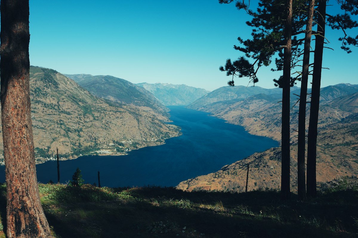
The Chelan people
Lake Chelan takes its name from the Chelan people — the ščəl̕ámxəxʷ — an Interior Salish people whose name is often rendered as referring to deep water. For thousands of years before non-Native settlement, families lived in winter villages along the shore and traveled the lake and surrounding mountains in summer for fish, game, and trade across the Cascades.
Shoreline pictographs and oral histories document long continuity on these waters. Today the Chelan people are one of twelve bands of the Confederated Tribes of the Colville Reservation, a federally recognized tribe headquartered on the Colville Indian Reservation in eastern Washington.

Lake Chelan in the Cascade Mountains, photographed about 1908.
Pillsbury Picture Co., Library of Congress, Prints and Photographs Division (pan.6a16648). No known restrictions on publication. Source
The Moses Reservation and Wapato Point
In 1879 President Rutherford B. Hayes established the Columbia Reservation — often called the Moses Reservation — for Chief Moses and allied mid-Columbia peoples, including Chelan, Entiat, and Methow bands. The reserve included lands along Lake Chelan, but pressure from miners and homesteaders followed quickly.
In July 1883, Chief Moses and other leaders signed the Moses Agreement in Washington, D.C., opening much of the reservation to homestead and mineral entry while allowing tribal heads of household who wished to remain to select allotments. The Wapato family, led by Nekquelekin (Wapato John), received allotment lands on the peninsula now known as Wapato Point, a traditional gathering place.
Congress later reduced allotment sizes. When the Chelan Dam raised the lake in the late 1920s, part of the allotted land went underwater. Descendants of the Wapato family retain inherited interests in the peninsula. An executive order in 1884 dissolved the Columbia Reservation; former reservation lands opened to settlement in 1886.
Settlement along the lake
Non-Native settlers arrived as reservation lands opened in 1886. At the foot of the lake, where the Chelan River drops toward the Columbia, the community that became the city of Chelan grew slowly; residents voted to incorporate in 1902. Up the south shore, deeper water at Lakeside (once called Lake Park) supported sawmills, boat landings, and early hotels until Lakeside merged with Chelan in 1956.
On the north shore, Manson developed around orchards and irrigation that turned benchlands into apple country. Mining prospectors worked the upper lake from the 1880s onward, and Stehekin became a lake port for supplies moving up Railroad Creek and other valleys.
The steamboat era
Before highways reached the upper lake, steamboats linked the railhead at Chelan with Stehekin, Lucerne, and scattered landings. The Belle of Chelan began running in 1889, followed by a succession of wood-fired and later vessels that carried passengers, freight, and mail.
The Lady of the Lake, launched at Lakeside in 1900, became the best known of the steamers. She made her final run in 1915 as gasoline-powered boats took over. Passenger service continues today under state franchise through the Lake Chelan Boat Company, whose vessels serve Stehekin, Lucerne, and flag stops year-round.

The original wood-fired Lady of the Lake on Lake Chelan, before 1915.
Washington State Historical Society (via Wikimedia Commons). Public domain in the United States (published before 1931). Source

Lakeside landings
Photographs from the turn of the twentieth century show multiple steamers tied up at Lakeside, then the industrial heart of the south shore. Similar views document vessels such as the Tourist working the lake on scheduled runs documented in 1908.

Steamboats at Lakeside, on the south shore of Lake Chelan.
University of Washington Libraries, Special Collections (Prosch Washington Views Album, PH0028). Public domain in the United States (published before 1931). Source

Documented runs
Lawrence Denny Lindsley and other photographers recorded the Tourist and competing boats on the open lake, preserving how residents and visitors experienced the fifty-mile passage before modern roads.

The steamboat Tourist on Lake Chelan, June 11, 1908.
Lawrence Denny Lindsley, University of Washington Libraries (PH Coll 548). Public domain in the United States (published 1908). Source

Stehekin and the Field Hotel
Stehekin — a Salish name often interpreted as “the way through” — sits at the head of the lake where the Stehekin River enters. No public road has ever connected the community to the outside highway network; access remains by boat, floatplane, or trail.
Merritt Eugene Field arrived in Stehekin in 1892 and expanded early lodging into a destination hotel. By the early 1900s the Field Hotel offered dozens of guest rooms and drew visitors from far beyond the valley. Field later served in the state legislature and supported legislation that created Chelan County in 1899.
The Great Northern Railway purchased the hotel in 1915 as planners prepared to raise the lake. The structure was dismantled before the water rose; salvaged timbers and finishes were hauled across the frozen lake and reused in the Golden West Lodge, which opened near the new landing in 1927 and now houses National Park Service visitor facilities.
Holden and Railroad Creek
Prospectors staked claims in the Railroad Creek valley by the 1890s after engineers noted copper-stained outcrops. Decades of exploration preceded industrial mining under the Howe Sound Mining Company, which began production in 1938 and operated a company town at Holden until closure in 1957.
Ore moved by truck to Lucerne, by barge downlake, and by rail from Chelan Falls. After closure, the Lutheran Bible Institute received the townsite for a retreat that became Holden Village. Mining left tailings and waste rock that later required federal cleanup; remediation work has continued under U.S. Environmental Protection Agency oversight.

Mining activity at Holden, Railroad Creek valley, August 1909.
Lawrence Denny Lindsley, University of Washington Libraries (PH Coll 548). Public domain in the United States (published 1909). Source

Chelan Dam and Chelan County PUD
The Chelan River’s steep drop to the Columbia attracted early dam builders. The present Chelan Dam, completed under Washington Water Power in 1927, raised Lake Chelan by about 21 feet. Stehekin structures, docks, and roads that sat near the old shoreline had to move to higher ground.
Chelan County Public Utility District No. 1 acquired the project in 1955 and operates it today as a source of renewable power for county customers. The dam, conveyance system, and powerhouse are listed in the National Register of Historic Places.
Lake Chelan National Recreation Area
On October 2, 1968, President Lyndon B. Johnson signed legislation creating the North Cascades National Park Service Complex, including Lake Chelan National Recreation Area at the head of the lake. The unit protects the Stehekin valley and lower Stehekin River while accommodating a year-round community that predates the park.
Visitors still reach Stehekin primarily by boat, much as travelers did in the steamboat era — across the same deep water the Chelan people navigated long before the first sternwheeler sounded its whistle at Lakeside.
Sources
- Lake Chelan State Park history — Washington State Parks
- Stehekin — North Cascades National Park Service
- Lake Chelan National Recreation Area — National Park Service
- Lake Chelan Dam — Wikipedia
- Chelan, City of — HistoryLink.org
- Chelan residents vote to incorporate, 1902 — HistoryLink.org
- Boat history on Lake Chelan — Cascade Loop
- Holden Village history
- Holden Mine cleanup — U.S. Environmental Protection Agency
- Wapato Point and Colville Tribal history — Confederated Tribes of the Colville Reservation
- North Cascades National Park Complex — enabling legislation (1968)
- Lake Chelan — Library of Congress panoramic photograph (1908)